My new book THE POCKET WEATHER FORECASTER is out now!
It is every sailor's guide to clouds and the weather they foretell. At 84-pages and full colour the book easily slips into a kit bag and is written in a non-scientific easy to read way.
You can order it now online at http://www.weatherweb.net/books.htm" onclick="window.open(this.href);return false; and see sample pages there too.
*******************************************************************
Hello again,
Thanks to all of you who have bought my book so far. I’ve received lots of feedback (positive I’m pleased to say) and it is good to know that The Pocket Weather Forecaster has become an important part of your kit already!
Remember that we are here to help you. If you are planning a trip then we can write a forecast specifically for you (just see http://www.weatherweb.net/buy.htm" onclick="window.open(this.href);return false; for details). Or, if you want to talk directly too us you can call 0906 515 0036 and pay £1.50 p/min or call 01902 895252 and pay a fix price of £12 per call (make sure you tell the forecaster immediately that you want to pay by credit card). However you get your forecast, we are here all weekend.
Weatherweb.net has been updated and now carries many more forecasts. I am working on adding more too. There are now:
Surface frontal charts to 5 days ahead
Detailed wind forecast charts for regions of the UK to 5 days ahead
5 day forecast texts for the UK, Ireland, France, Mediterranean and Europe
Satellite cloud forecasts for Europe
Month Ahead and Seasonal forecasts
So if you haven’t visited lately see http://www.weatherweb.net/uksail.htm" onclick="window.open(this.href);return false;
Onto the weekend forecast, and if you know anyone who’d like to receive this email each week just tell them to send a request to join to sailingweather-subscribe@weatherweb.net
Best wishes,
Simon
WEEKEND WEATHER FORECAST
Issued: 1100 Thursday 18th June 2009
SATURDAY:
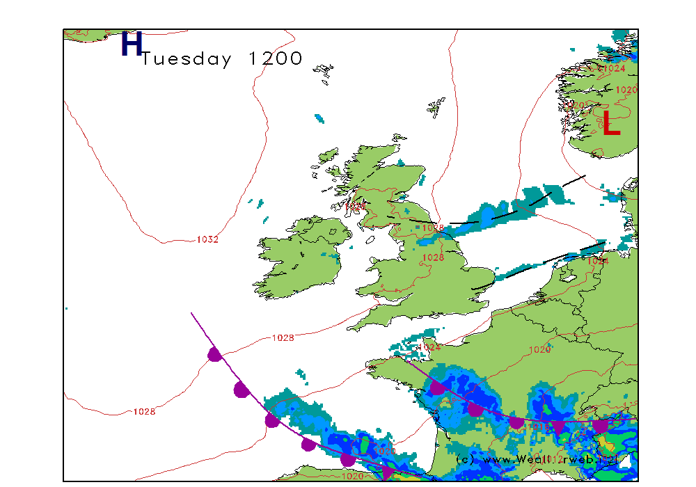
A trough (represented on the chart by a series of fronts) is going to be making its way eastwards on Saturday morning. A ridge of high pressure should build in from the Atlantic behind this feature.
I think that for many of us it is likely to be a fairly showery start to the morning. Most of the showers over Scotland, northern England, the Midlands and East Anglia with cloudy conditions too. Slowly, drier and brighter weather should move through Ireland and western Scotland, as well as the west of Wales and southwest England with the cloud breaking and lifting.
The afternoon should see the showers fading away from East Anglia and the southeast of England. All parts of the country should then become dry with well broken cloud and some sunny spells.
Later in the day thicker cloud will arrive in western Scotland and western Ireland, ahead of the warm front, and this could bring some patchy rain to these places by the evening.
Winds will be mainly WNW 12-15kt (F4) easing to 8-12kt (F3-F4) later and backing over western Scotland and western Ireland as the front edges closer.

SUNDAY:
Low pressure is tracking to the north of Scotland on Sunday, pushing a warm front eastwards into the North Sea as it goes. High pressure remains south of Ireland influencing conditions over much of the south of the country.
For Scotland, northern England and Northern Ireland the day is likely to be a rather cloudy and damp one. Typical warm sector conditions here with lots of cloud, outbreaks of drizzle and rain, with the heaviest of this on windward facing slopes and coasts. Some eastern parts of Scotland and northeast England are likely to brighten up in the afternoon with sunny spells coming through, and feeling warm in these too.
For southern England, Wales and southern Ireland it should be largely fair, although with rather a lot of medium and higher level cloud. This will make the sunshine hazy, especially through the Midlands, Wales and Ireland. There is the chance too of a few spots of rain in northern parts of the Midlands and Norfolk towards the evening. Where it stays dry it will be feeling warm, especially in the south. Western coasts of Wales, southwest England and southern Ireland could have some mist and fog patches drifting in from time to time.
Winds will be a WSW-SW 20-28kt (F6) over northern and western Scotland, nearer W-WSW 8-12kt (F3-F4) for southern areas with sea breezes forming along southern coasts.

***ends***


