BOOK AHEAD FORECASTS:
Our forecasters will write a forecast specifically for you, and email it to you.
Simply book in advance and we'll email the forecast to you at the time you specify.
You'll also be able to telephone the forecaster to discuss the forecast.
Forecasts can be made for anywhere in the world, and cost just £17 (inc VAT).
To book your forecast go to http://www.weatherweb.net/" onclick="window.open(this.href);return false; buy.htm
************************************************************************
Hello again,
Another Wednesday issue of the Weekend Forecast, hope this is okay for you.
Weatherweb.net has been updated and now carries many more forecasts. I am working on adding more too. There are now:
• Surface frontal charts to 5 days ahead
• Detailed wind forecast charts for regions of the UK to 5 days ahead
• 5 day forecast texts for the UK, Ireland, France, Mediterranean and Europe
• Satellite cloud forecasts for Europe
• Month Ahead and Seasonal forecasts
So if you haven’t visited lately see http://www.weatherweb.net/uksail.htm" onclick="window.open(this.href);return false;
Winter has not abandoned us just yet and I think for many of us there could be some snow showers this weekend.
Onto the weekend forecast, and if you know anyone who’d like to receive this email each week just tell them to send a request to join to sailingweather-subscribe@weatherweb.net
Best wishes,
Simon
WEEKEND WEATHER FORECAST
Issued: 1800 Wednesday 25th March 2009
SATURDAY:
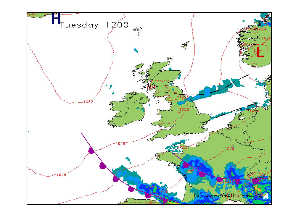
An unstable Polar Maritime airmass covers the British Isles through the course of Saturday. However, a ridge builds into Ireland and this will have the effect of forcing the troughs further eastwards into the North Sea, and I suspect that most of the influence of the troughs will be to the north and east.
There will be frequent wintry showers across northern and eastern parts of Scotland, as well as the east of England. The showers are going to be wintry at times, with snow even to lower levels at times. Gradually through the day the showers should become more scattered as they get pushed east by the ridge of high pressure.
For more western areas there will be heavy showers too, and again these could be wintry. The showers becoming more isolated into the afternoon and there will be sunny spells between the showers throughout. Much of Ireland should become dry.
Winds will be NW 25-35 (F6-F 8 ) along eastern coasts, nearer NW 20-30 (F6-F7) further west, although these winds easing later to a NW 18-25 (F5-F6).
SUNDAY:
The ridge of high pressure from Saturday afternoon is only a transitory feature. By the middle of the day on Sunday a deep area of low pressure is centred to the north of Scotland and this is going to be blowing fronts eastwards during the course of the day.
A very windy day with severe gales possible for many.
A fair start through the far southeast of the country, with some sunny spells here. Rain will be falling through Ireland and western Scotland in the morning, heavy at times, and this is going to be sweeping eastwards into the afternoon. Some of the rain may be heavy over the hills of northern England and Wales. Persistent showers and long spells of rain for the north of Scotland too.
Behind the cold front an improvement should occur, there will be sunny spells and a scattering of showers, some of them heavy at times.
Note that the timing of the fronts is unclear at the present time and so keep a close eye on the forecasts.
Winds will be SW 12kt (F4) in the southeast at first, quickly increasing to a SW 25-35 (F6-F 8 ) with gusts to gale force, and to severe gale force in the west and north. Behind the cold front the
winds become W 25-30 (F6-F7).
***ends***


