SAILING WEATHER SCHOOL (PART1) - WHAT YOU REALLY NEED TO KNOW ABOUT WEATHER!
The next Sailing Weather School (Part 1) will be held on Saturday 7th February 2009. I have had a couple of cancellations, so I have two places remaining on this one-day course.
Whether you are a new to sailing, or an experienced yachty, you will find Weather School fascinating. My aim is get you into the mind of a forecaster and show you why the weather works, building your confidence in making your own predictions and helping you to make sense of the plethora of weather information available on the internet. The cost of the full day course is £115 (inc VAT) and this includes lunch and refreshments throughout the course. For more information or to book online see http://www.weatherschool.co.uk" onclick="window.open(this.href);return false;
************************************************************************
Hello again,
Happy New Year!
I hope life is returning to somewhat near normal for you following the Christmas break. The weather is looking set to change into a new pattern next week, although cold air is never far away on the continent and so we could see a return to the colder conditions. Our 30 and 90 day forecasts though do suggest that February may be a little milder than normal and that march may be a rough month with plenty of strong winds and rain.
Get set for the weather giving us a demonstration in how atmospheric models handle the breakdown of a cold snap. Frequently the models want to break the weather down too quickly, and almost always high pressure holds on over the Continent for longer than is initially expected. I think this is going to happen this weekend. Successive runs of the model will delay the retreat of the cold weather ever so slightly, eventually being perhaps 24-hours out. Will forecasters be caught out by this? As the warmer air arrives form the west mist and fog could become quite extensive with murky days ahead. Of course, I could be wrong, but it will be an interesting one to follow.
Weatherweb.TV will be available throughout the weekend as usual, and the learning Channel is there too to help some basic weather concepts.
Onto the weekend forecast though, and if you know anyone who’d like to receive this email each week just tell them to send a request to join to sailingweather-subscribe@weatherweb.net
Best wishes,
Simon
WEEKEND WEATHER FORECAST
Issued: 0900 Thursday 8th January 2009
SATURDAY:
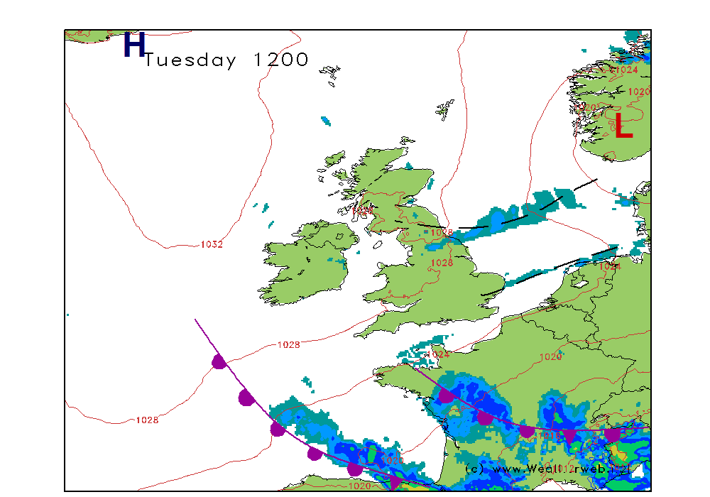
High pressure is going to be holding on through much of England and Wales as well as southern Ireland today. This brings plenty of mist and fog to many parts. Through Scotland and northern Ireland the southwest wind will be increasing as an occluded front moves close to western coasts of Scotland. Winds exceeding gale force here.However, that high pressure to the east is very reluctant to move anywhere particularly fast.
So for much of England, Wales and southern Ireland I suspect that the day is going to be a misty, murky one. There will be fog patches through many areas and these could be dense. However, where the fog does manage to lift and break through the morning the sun should come through leading to fair conditions. Increasing cloud over Wales and northern England aiding the lifting of the fog, so some hazy sunshine here.
For western Scotland and western Ireland the cloud is going to be thickening all the time. This will be bringing outbreaks of drizzle rain in the morning, this then turning more persistent for the afternoon. Remaining dry through eastern Scotland.
Winds will be mainly S’ly 3-8kt (F2-F3) over much of England, becoming S 10-15kt (F4) later in the western Channel and Wales and S-SW 15-20kt (F5) through northern England.
Mainly SW 25-30 (F6-F8) gusting 40kt (F9) in Scotland.
SUNDAY:
The area of high pressure retaining its hold over the south and east of England today. A warm front crossing the north brings increased cloud here, but this front is weakening. The main feature is the cold front moving into western Ireland and western Scotland which will bring some heavier periods of rain.
Rather misty through southern and southeastern areas of England, perhaps with some fog patches at first. These clearing as the wind increases and some bright spells will come through too.
For west Wales and northern England it will be windy with increasing low cloud and some drizzle in the west, together with fog on hills, but perhaps at lower levels too as the warm front arrives.
Most of the rainfall, and the strongest winds are reserved for the west of Scotland and Ireland. A few heavy bursts of rain here, whilst the east of Scotland and eastern Ireland are drier, but still with a few outbreaks of mainly light rain.
Winds mainly S-SW 8-12kt (F30F4) in southeast England, SW 25kt (F6) in west Wales and northern England occ 30kt (F7) on exposed coasts later. SW 30-40kt (F7 gust F9) over Scotland and Ireland.
**ends**


