BOOK & BUY PERSONALISED FORECASTS:
Our forecasters will write a forecast specifically for you, and email it to you.
Simply book in advance and we'll email the forecast to you at the time you specify.
You'll also be able to telephone the forecaster to discuss the forecast.
Forecasts can be made for anywhere in the world, and cost just £17 (inc VAT).
To book your forecast, and to see a sample, go to http://www.weatherweb.net/buy.htm
************************************************************************
Hello again,
It’s all a bit of a mess this weekend. We’ve fronts meandering around the country, pressure trying to build and a tricky time of the year to forecast. I’ll try my best but do keep a careful watch on the forecast if you have plans for the weekend.
You can watch the forecast for the weekend, 5-day outlook and learn more about the weather at Europe’s first WebTV weather channel, Weatherweb.TV now! Forecasts at Weatherweb.TV are updated every day.
If you want to receive this email each weekjust send an email to aviationweather-subscribe@weatherweb.net
Best wishes,
Simon
WEEKEND WEATHER FORECAST
Issued: 1500 Thursday 11th September 2008
SATURDAY:
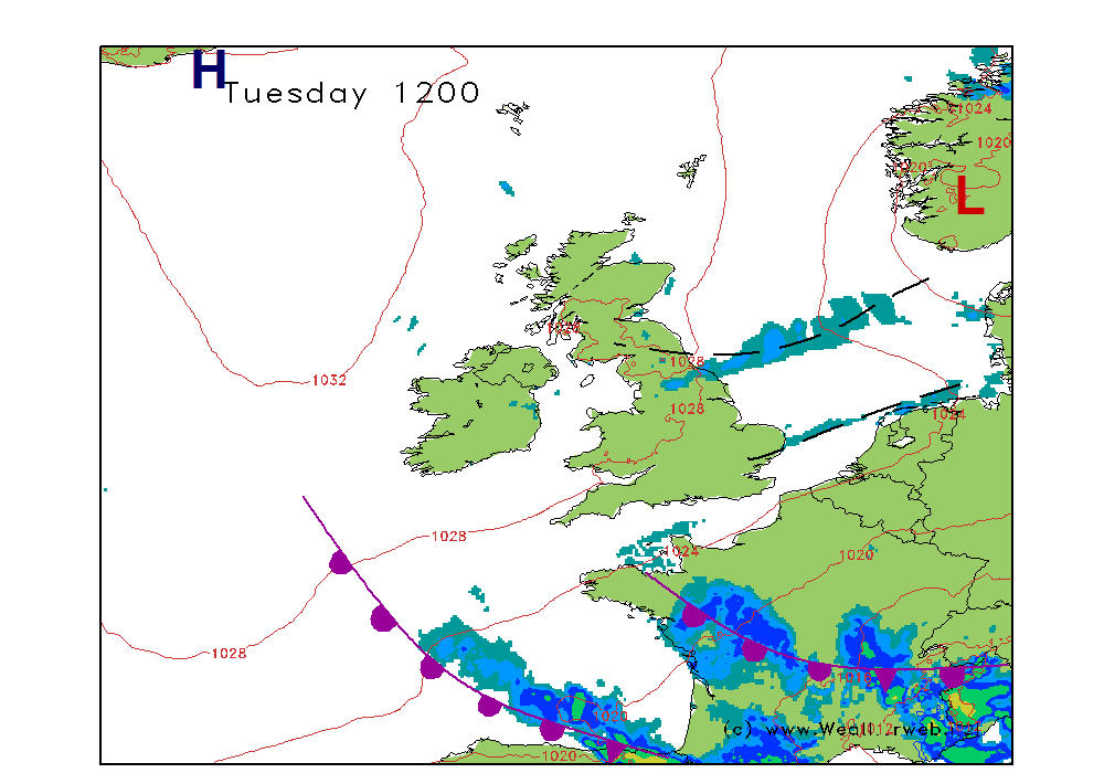
A couple of weak fronts are expected to be affecting the country through the day; mainly through the Midlands and northern parts of the country the fronts will be bringing some spells of rain and drizzle. Pressure is going to be generally high thanks to high pressure situated in the Bay of Biscay.
A fair amount of cloud through much of the Midlands, eastern and northeast England as well as Scotland this morning. There will be some outbreaks of rain and drizzle at times, with the focus for these over the far north of England and eastern and central Scotland.
To the west conditions should be drier. There will be some sunshine coming through across Wales, southwest England, western Scotland and Ireland.
However, thicker cloud and rain may reach western parts of Ireland later.
Winds will be variable, mainly W-WNW 5-10kt (F3) to the south, SE 8-12kt (F3-F4) in the north but SE-E 15kt (F4-F5) at times on eastern coasts. Mainly S 8-12kt (F3-F4) over Ireland.
SUNDAY:
The occluded front is still going to be from Scotland to eastern England on Sunday, weakening further but bringing annoying amounts of cloud and some morning drizzle. A more active front appears to be moving through Ireland and into Wales and southwest England in the afternoon.
Rather a cloudy start for most of the country. Some outbreaks of rain or drizzle in the north and east but a tendency for these to be slowly fading into the afternoon.
Further west it should be brighter over Wales and southwest England, but at the same time rain is going to be moving through Ireland. This rain could become more persistent into the afternoon and may stretch into Wales and southwest England by evening. Confidence in this is low at present.
Winds will be mainly SE 5-10kt (F2-F3) but 12kt (F4) along eastern coasts at times.
**ends**


