BOOK AHEAD FORECASTS:
Our forecasters will write a forecast specifically for you, and email it to you.
Simply book in advance and we'll email the forecast to you at the time you specify.
You'll also be able to telephone the forecaster to discuss the forecast.
Forecasts can be made for anywhere in the world, and cost just £17 (inc VAT).
To book your forecast go to http://www.weatherweb.net/buy.htm
************************************************************************
Hello again,
The 5-Day Sailing Forecast, Weekend Forecast and Channel Short Term Forecast are all now online and updated at Weatherweb.TV If you haven’t viewed the Channel yet do go and have a look and tell your friends about it.
And don’t forget that you can receive this forecast each week by email, just send an email to sailingweather-subscribe@weatherweb.net
Best wishes,
Simon
WEEKEND WEATHER FORECAST
Issued: 1200 Thursday 3rd April 2008
FRIDAY:
High pressure remains to the south of Ireland on Friday affecting most of southern England and Wales. A cold front is moving southwards through northern England and Ireland, reaching Wales in the evening. This is a weakening feature. During the evening an occluded front approaches northwest Scotland, the winds increasing here at the same time.
For much of the southern half of England, Wales and Ireland it will be a rather hazy morning with some mist in places. This clearing slowly to leave the day dry with variable cloud and a few bright spells.
For northern England and Northern Ireland the cloud from the cold front will be bringing some spots of rain, although this not amounting to very much, and then to brighten up here in the afternoon.
Across Scotland cloud and rain clears the south in the morning to be followed by much brighter skies. Showers will be affecting the north and west, these heavy at times. To the east it should be drier, although a risk of showers here too.
Winds W 5-10kt (F2-F3) in the south, becoming SW-W 10-12kt (F3-F4) in northern England and Ireland, increasing to W 20-25kt gust 30kt (F5-F6 gust F7 or F8 later) over northern Scotland.
SATURDAY:
The cold front clears southwards on Saturday with a cold northwesterly flow affecting the whole of the country. Showery troughs push southwards with the flow.
There will be wintry showers across most parts of the country, with the heaviest of these through Scotland and down the eastern coasts of England. The showers tending to move southwards in bands, associated with the troughs.
The least of the showers in southern England and the Midlands as well as through the English Channel.
Winds will be from the N or NW at 12-15kt (F4) but NW 20-25kt (F6) through Scotland and 30-35kt (F7-F8) in northern Scotland.
SUNDAY:
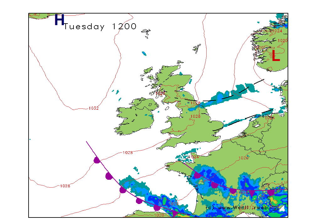
Low pressure centred in the North Sea off the west of Denmark on Sunday, with showery troughs pushing southwards through the country. The cold, flow persists through all areas.
Another day of sunshine and showers is likely for all of us. The showers will be wintry in nature with them falling as sleet and snow at times. The heaviest of the showers around northern and eastern areas, but also through Wales, Ireland and parts of Cornwall and the Scilly Isles.
Winds will be NW 15kt (F4) over much of southern England and south Wales, NW 15-20kt (F5) through northern England, north Wales and Ireland and NW then NE 20-30kt (F6-F7) over Scotland gusting F8 in the north.
**ends**


Simon Keeling MSc (Appld. Meteorology & Climatology), FRMetS
Weather Consultancy Services
The Weather Centre, 188 Common Road, Wombourne,
Staffordshire, England. WV5 0LT.
Tel: (01902) 895252
http://www.weatherweb.net
http://www.weatherschool.co.uk
http://www.simonkeeling.co.uk

