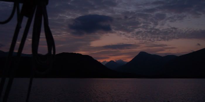
However, as a passage, it had its interesting moments, not the least being passing under the Connel Bridge and, some miles further east, under the HT cable at Bonawe. It is a passage we'd fancied making for several years, although slightly put off by the apparent absence of a modern chart. After reading cpedw's positive account of sailing in Loch Etive in 2004, we had purchased the cancelled Admiralty chart 2378 complete with beautiful land contour drawings and leadline depths in fathoms. However it seems that a new chart 2388, Loch Etive and Approaches, was published in2006. It also appears on the UKHO/RYA CD-ROM "Area3, West of Scotland".
As to the electricity cable, we were encouraged by cpedw's observations. His advice concerning the HT cable clearance on the north bank was, gratifyingly, spot on. Thanks Derek!
The first thing was getting through the Falls of Lora, and clearing the Connel Bridge. The Clyde Cruising Club Sailing Directions (2000 edition) were very clear about the safe passage under the bridge (shown below);
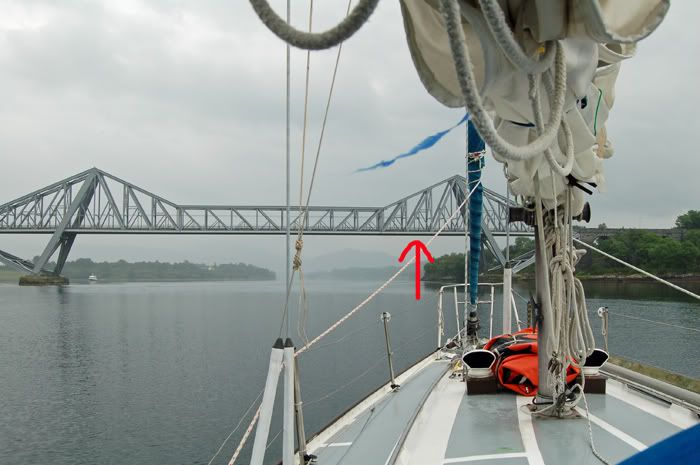
The SDs also advise going through in slack water, and explaining that because of the rock barrier that create the "Falls", slack water is HW Oban +0200 and LW Oban +0230. Connel Bridge has a charted clearance of 14m clearance (my edition of the CCC SDs claim 15m), so we made careful calculations and went through at Neaps HW +0200 slack, giving adequate clearance for our 12.6 mast and aerial, plus the better part of a couple of metres from waterline to the base of the mast. With hindsight, we should probably have been made our first transit at slack LW +0230 as the charted dangers would have been exposed.
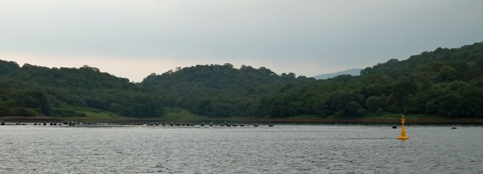
Once in the loch, and clear of the Kilmaronaig Narrows, we had a look at Bonawe pier on the south side of Airds Bay, but with two submarine cables in its vicinity, anchoring there didn't seem particularly attractive.
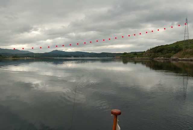
We therefore studied the height of the cable crossing Bonawe Narrows which has a charted clearance of 13 metres on Chart 2388 (the SDs say 12m at high water). The lower of the the three cables clearly drops considerably, so with the neaps tide now well on the ebb we decided to go through about 20m off the the north bank, all in safe water. But, of course, no matter how careful your calculations, or rational you assume your judgement to be, the threat of high voltage fairly concentrates the mind, and there is still that nagging doubt as the mast approaches the overhead cables.
In the event, there was a lot of space between the masthead and the cable. Looking back south, from the north, and by superimposing red dots to plot the position of the lowest of the three HT cables, it may be seen that there is considerable sag in the middle of the span, with much more clearance on the north/west side to the right of the picture;
Once clear of the cables, we headed north, taking a look at Port an Dobhrain, or Glen Noe Bay.
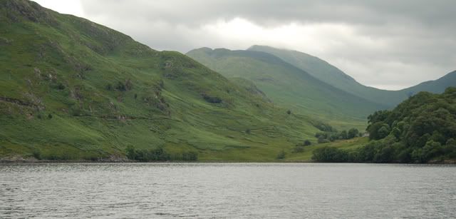
- Port an Dobhrain, Glen Noe Bay, Loch Etive
The CCC write up was decent enough, but we decided to anchor overnight in Inverliever Bay, about a mile and a half to the north east. The SDs suggest anchoring in 10m owing to the proximity of boulders. We anchored in 9m chart datum - that extra metre weighs a lot when you're pulling the anchor up by hand. We attached a tripping line, but didn'd need to use it. The anchor had however set well in the mud.
The following morning we were joined by a fine looking motor boat, Samara of the SMYC (Severn Motor Yacht Club?).
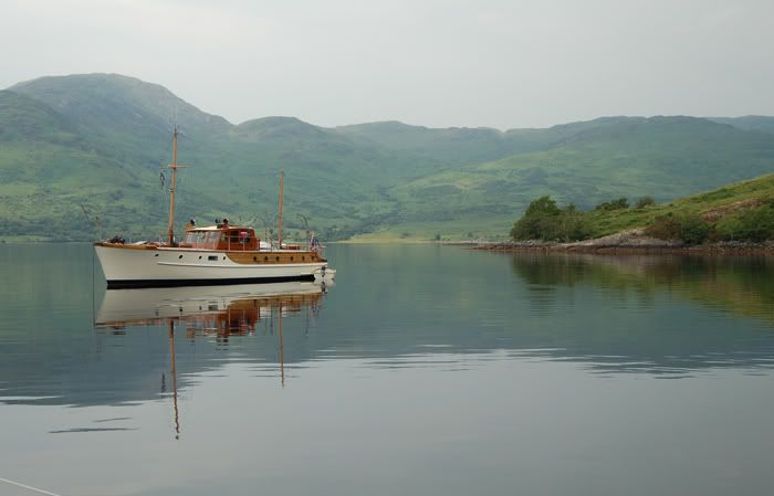
- "Samara", in Inverliever Bay
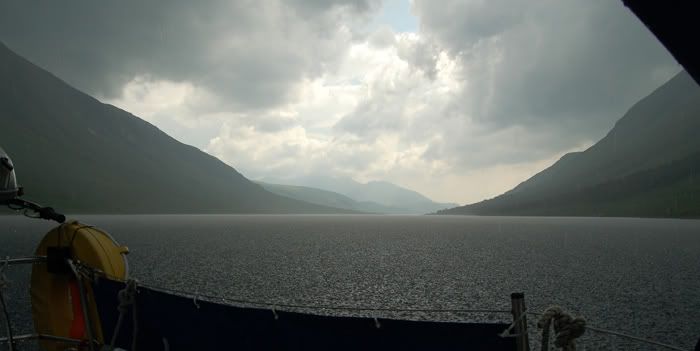
The weather broke as we sailed north with a following breeze. With thunder and lightning, and heavy rain, the wind died, and we rolled away the genoa and motored to the head of the loch.
As we wanted to go ashore when the weather improved (it did), we anchored on the north west side, just a little to the north of the jetty. We found that the ground seemed reasonable and had no difficulty with the breeze which came from the NE (the low clouds were rolling in from the SE). It was ideal for an overnight anchorage in these conditions.
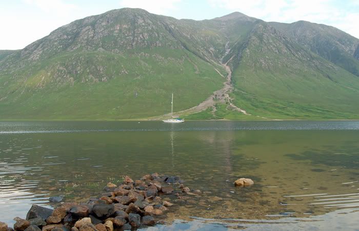
- Anchored at the head of Loch Etive, Ben Starav in the background.
We spent a peaceful night there;
While north of Bonawe, we saw only four boats - a small angling day boat, a slightly larger fishing boat, MY Samara, and a canoe complete with sail and two outriggers.
On our return passage, we anchored at Sailen Ruadh, tucked in behind the mussel farm, to wait for slack water Connel Bridge. This is a well sheltered north facing anchorage;
+++++++++++
Some comments;
- Loch Etive feels like an inland loch - unlike, say, Loch Fyne, there is no sense of being at sea;
It's no great deal - plenty of boats go there;
With care, the difficulties at Connel Bridge and Bonawe Narrows can be overcome by carefully following the Sailing Directions;
Shard takes no responsibility for anyone daft enough to take unnecessary risks with the HT cable;
The midges are more of a problem than at a coastal anchorage;
The clegs are something else;
The old jetty at the head of the loch is being replaced by a stone and pontoon pier (for shipping out the forestry harvest);
As with similar lochs bounded by mountains, the breezes can be freaky;
The scenery is spectacular;
There are no known facilities;
The wilder areas beside the loch are free of sheep and cows, so I would have had no problem taking on water from the burns.
Finally, just a personal note. While I was still at school, probably in 1964, I spent a few weeks of a summer holiday working for the Forestry Commission in Glen Etive. With a couple of other lads, one from Glasgow and the other from Dalmellington, our task was to cut the bracken from around the recently planted trees. We were on piece rate, paid by the totalled acreage of cut bracken. I was pretty useless at it, and was probably responsible for chopping lots of little trees. Anyway the forest seems to have recovered, and I assume that it is these trees (or perhaps a later generation of them) that are now being harvested.
The three lads, and possibly the ganger, stayed in the forestry bothy. Next door was Ian Auld with his wife and IIRC two young children. He later ran a pub in Largs. Mrs Auld made the breakfasts, our pieces, and our suppers. The ganger by the name of Kennedy was a very decent bloke from south Ayrshire, and had a degree in biology and/or forestry management, yet he had to labour away at the bracken at rates of pay not much better than we had. The other man I remember in the gang was great fun; Charlie Cattanach from Ballachulish. He lived in the glen and had a very young baby daughter. Finally, the ditching for the new tree plantation was undertaken by contractors, Charlie Buist and his mate. I sometimes wonder what became of them all.
Some of the glen was owned (at that time at least) by members of the Fleming family, who had made their wealth through merchant banking and, possibly, shipping. Ian Fleming, creator of James Bond, 007, was part of that family.
There was of course no pub in the glen, the nearest being at Kingshouse, to which two of us walked the twelve or so miles, there and back, for some illegal under-age drinking on a Saturday night. Took about three or four hours each way, and I think we would get back to the bothy, stone cold sober, at around 4:00 AM, just as the sun was preparing to get out of its bed.
At that time, in the Sixties, the pubs were shut on Sundays and only "bona fide" travellers could buy drinks at a hotel or similarly respectable premises. There was, however, a "ferry" service on a boat called the Shearwater that ran up and down the loch from Connel. Now the Shearwater was licensed to sell alcoholic beverages, so Sundays were particularly busy days.
As far as I recall, there was only one telephone line to the bottom of the glen, from which the houses were then connected via a small house exchange switchboard run by the head forester's wife in her living room. The house extensions could "tinkle" their phones to talk to each other without being being billed for it, so when a "strange" car was seen coming down the glen, there would conversations about which house or farm it had stopped at, and discussion as who the callers were, and who their relations were.
Walking around the south end of the glen the other day, I found that I really couldn't remember any of the farm buildings or local features, despite having visited on a few subsequent occasions (I'd climbed on a couple of occasions on the Etive Slabs on Beinn Trilleachan). Also, remember it being much more open, with far fewer trees near the road.
Changed days.