WEATHERLIVE – SPEAK TO OUR FORECASTERS
This service is available between 8am and 6pm everyday of the year. Just call and talk live to our forecasters for the very latest weather forecast specifically tailored for you. We aim to keep call times to a minimum with each call lasting approximately 2 to 3 minutes.
Weatherlive is available on 0906 515 0046.
Calls cost £1.50 per minute from landlines, some mobile rates may vary.
************************************************************************
Hello again,
The days are getting longer and high pressure is building to the south....ahhhh....spring cannot be that far away (can it?).
Onto the weekend forecast, and if you know anyone who’d like to receive this email each week just tell them to send a request to join to sailingweather-subscribe@weatherweb.net
Best wishes,
Simon
WEEKEND WEATHER FORECAST
Issued: 1100 Thursday 19th February 2009
SATURDAY:
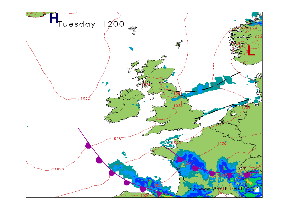
High pressure is going to be centred to the south of Ireland today, and this will be dominating the weather across much of the country. A warm front will be clearing southeast England in the morning, ahead of a cold front which will be moving into western Scotland and Ireland through the afternoon.
The warm front is likely to be bringing low cloud and some outbreaks of patchy drizzle through more southeastern areas on Saturday morning. These should be fading away and then the cloud should break here with a few bright spells coming through.
For much of the rest of England, Wales, eastern Scotland and eastern Ireland the day should be dry with some sunny spells coming through, although still some cloud floating around.
Thicker cloud and increased winds affect northern and western Scotland as well as western Ireland where the cold front will bring the threat of more persistent rain in the afternoon. This rain could be heavy on western facing hills.
Winds will be mainly W 7-12kt (F3-F4) in the south, nearer SW 15-20 (F5) over Scotland but up to 25-30kt (F7) in the northwest later.
SUNDAY:
High pressure remains to the southwest of Ireland through Sunday with west to northwesterly flow affecting much of the UK and Ireland. The cold front clears south overnight, taking some patchy rain with it. Into the afternoon a warm front approaches western Scotland where conditions are likely to be more breezy.
Probably a fair amount of cloud around on Sunday morning, although there will be breaks appearing through more central and southern areas. Little change over England, Wales and much of Ireland in the afternoon where it stays breezy with a fair amount of cloud but generally dry.
For western Scotland cloud thickens for the afternoon and outbreaks of light rain spread to the west, this perhaps extending to northwest England later. A tendency for low cloud to shroud the hills here as the rain moves in. Gales could affect northern Scotland.
Winds will be WNW 12-17kt (F4-F5) in the south, increasing as you head north to be W-WNW 30-35 (f7-F8 ) over northern Scotland.
***ends***


