BOOK & BUY PERSONALISED FORECASTS:
Our forecasters will write a forecast specifically for you, and email it to you.
Simply book in advance and we'll email the forecast to you at the time you specify.
You'll also be able to telephone the forecaster to discuss the forecast.
Forecasts can be made for anywhere in the world, and cost just £17 (inc VAT).
To book your forecast, and to see a sample, go to http://www.weatherweb.net/buy.htm
************************************************************************
Hello again,
Here comes the weekend again, probably not as good as last week but there should be some pleasant weather around, especially on Sunday.
A more detailed weekend forecast can be watched at Weatherweb.TV and there are all the other forecast on there as well, available free to view at anytime.
You can receive this forecast by email each week. Just send an email to sailingweather-subscribe@weatherweb.net
Best wishes,
Simon
WEEKEND WEATHER FORECAST
Issued: 0900 Thursday 17th July 2008
SATURDAY:
Low pressure in the North Sea at midday on Saturday. A cold front clears southwards in the morning and is then followed by an unstable, showery northwesterly airstream.
It will be a showery day for most of the country. The heaviest of the showers through Scotland and eastern parts of England. However, there could be some heavy showers in western England and Wales in the morning, but these will tend to become more scattered into the afternoon.
Over Ireland it will become basically dry by the evening, and this dry weather will be edging slowly eastwards.
Winds will be mainly W 12-15kt (F4 occ F5) ahead of the cold front, becoming NW 12-15kt (F4 occ F5) behind it. Note that winds could be 20-25kt (F6) along eastern coasts of Scotland and England.
SUNDAY:
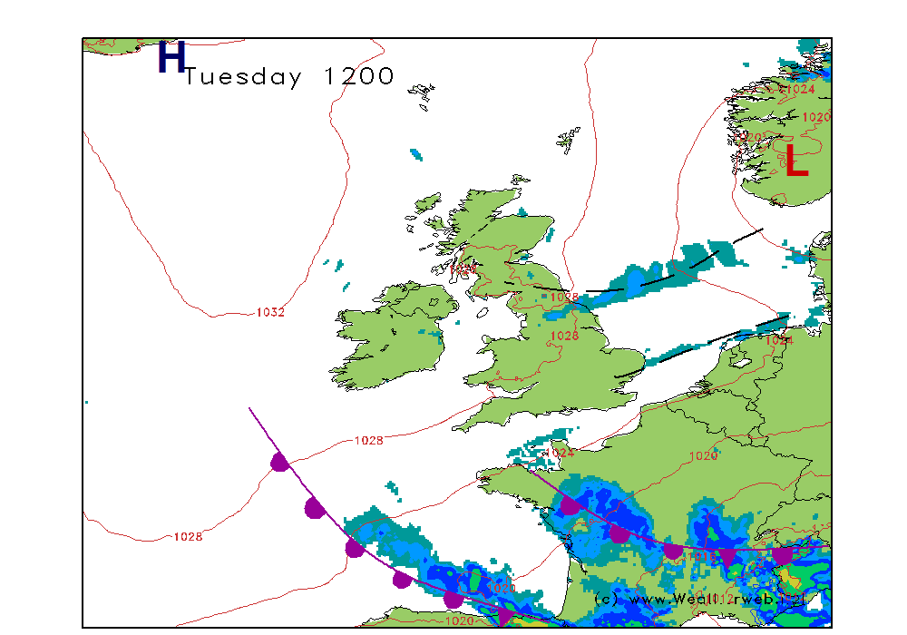
Low pressure becomes centred over southern parts of Norway, with higher pressure to the southwest of Ireland, extending a ridge eastwards through the British Isles and Ireland. Showery troughs move southwards along North Se coasts.
So there will be showers along the eastern coasts of Scotland and England. A few of the showers could be heavy at first, but they should become more scattered into the afternoon.
Further west it is likely to be dry with some sunny spells, although there is the threat of some broken cloud. The best of the sunshine over southern Ireland and southwest England.
Winds will be NW 10-15kt (F4) but NW 18-22kt (F5 occ F6) along eastern coasts of Scotland and at first over eastern England.


**ends**

